Walking the Canberra Centenary Trail

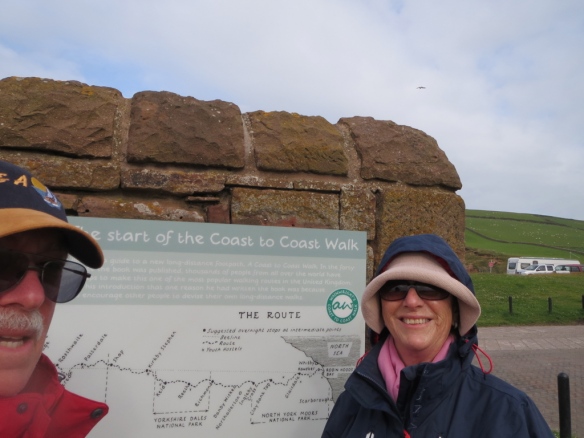
Last month John and I put our walking boots on to hike a section of Canberra’s newest walking trail, the Canberra Centenary Trail.

So-called because it was launched for Canberra’s 100th birthday in 2013 and gifted to its citizens.

Canberra, for those who don’t know much about Australia, is the nation’s capital. It sits in the Australian Capital Territory, a small spot about three hours from the east coast in New South Wales.

www.whereis.com

Map of Australia from www.whereis.com website

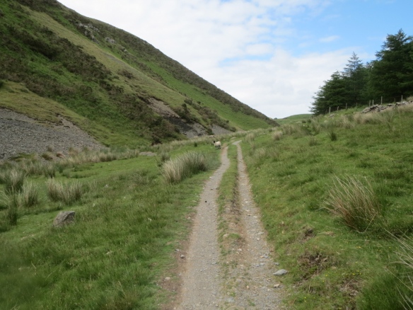
The trail’s a 140 km loop that rings the city, passing through the city, suburbs and surrounding bushland, taking in many of the local landmarks, man-made and natural. It’s broken up into seven sections, each do-able in a day.

There isn’t any overnight accommodation en-route, except for what you can find on the city and suburban sections, so you need to arrange transport to and from.

We had a standing date with some friends to do the walk in autumn when the weather was still fine but cooler. They had done part of section 4—Hall Village to One Tree Hill—last year and were keen to do it again, and as it was new to us we were happy to cruise on their advice.

walk map

Map of part of the Canberra Centenary Trail from www.canwalk.org.au website.

It was one particularly pleasant Sunday morning in March when we got the call: ‘Let’s do it!’

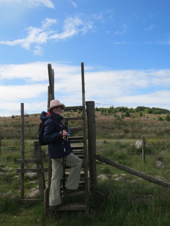
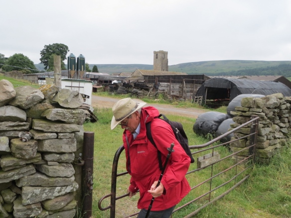
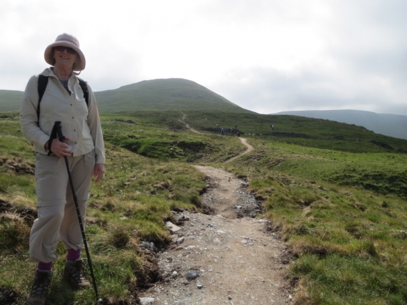
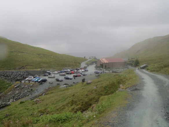
As per the arrangement we drove to Hall Village, parked behind the village at the start of the track, met up with our friends and set off. The plan was to walk to the One Tree Hill lookout, have lunch, then walk back to Hall Village. And that’s exactly what we did!

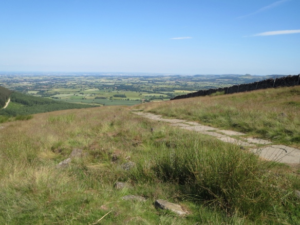
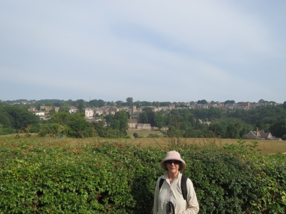
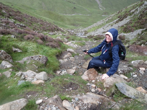
It’s not a long or arduous walk so you can concentrate on the scenery and picking out the various parts of Canberra, with your attention constantly diverted by the local birdlife. I was convinced that at times they were telling us off for disturbing them!

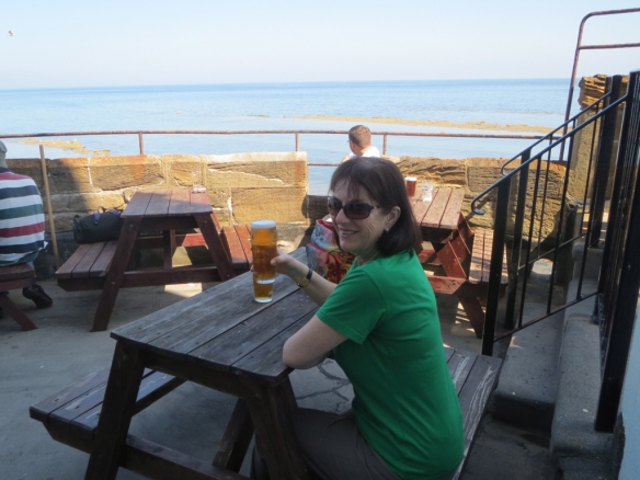
We had a good day. Weather warm but not hot, so no sweating involved. And fine skies, great for good photo results.

The one thing I hadn’t expected was the number of mountain bikers. They whoosh by, generally without warning, no bell ring or call of ‘Bike coming through’. The ones coming towards you are no problem, you can see them. It’s the ones approaching from behind that startle. The track is narrow and they’re not given to steering a wide berth because it would mean leaving the track, so they tend to cut it fine as they pass. Pity, because if they’d let us know they were coming we would have stepped aside.

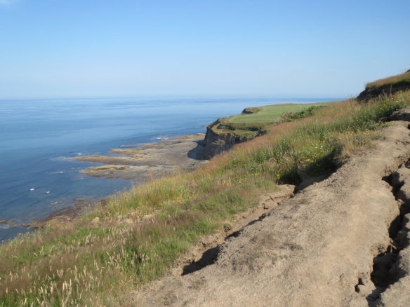
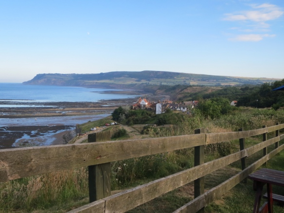
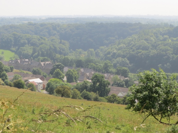
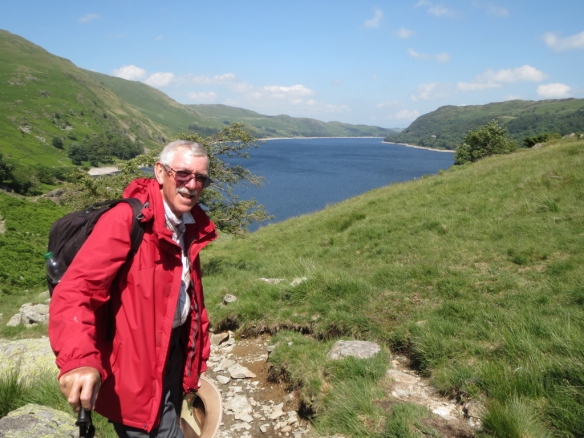
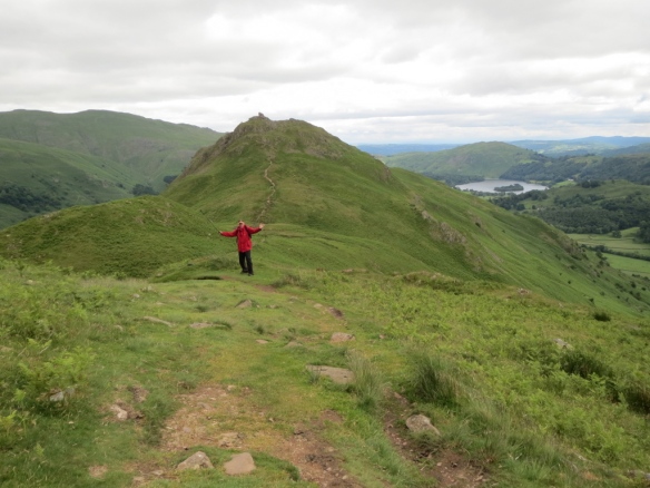
We finished our walk at the One Tree Hill lookout and admired the view while munching our sandwiches. It’s a great view all around—no wonder a fire tower was built there—but I especially loved looking towards the local mountain range, the Brindabellas. They’re what I see from my front deck at home and I never get tired of their moods.

thumb_IMG_1065_1024

One Tree Hill lookout

thumb_IMG_1067_1024

Across the valley to the Brindabellas

And then another leisurely stroll back to Hall Village for a coffee before parting ways to drive home.

A lovely way to spend an afternoon.

Across England on the Coast to Coast walk-visiting Whitby

Our walk across England from the Irish Sea to the North Sea may be over but we’re not in a hurry to leave North Yorkshire.

So we stay an extra day and take the local bus up to Whitby.  I’d visited the town in 2000 with our oldest daughter and wanted to show it off to John.

What I found was a town that had been discovered by the masses.  In 2000 there were tourists, sure, but it certainly couldn’t have been described as congested. Nowadays I’d say the locals would have a real love-hate relationship with the hordes that descend.

For those of you who don’t know, Whitby is a seaside town in North Yorkshire on the mouth of the River Esk.

The day we visited the sun was warm and the sky a bright blue with no clouds. It was gorgeous and we ambled around taking in the sights, enjoying just being able to stroll and not be anywhere in particular.

One of the features of Whitby is the Abbey.  In 2000 I was able to ramble through the ruins but today it’s walled off and you have to pay to get in.

Whitby 10
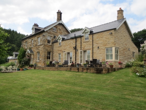
Back in 2000 my daughter and I overnighted in the YHA converted stables alongside the Abbey.  We were the only occupants for the night.  They’re now being converted into five star accommodation.

Whitby 6

One of my intentions while in Whitby was to buy something made of Whitby Jet as a momento of our walk.  While exploring the laneways we chanced across W Hamond, Jet Merchants, whose claim to fame is that the jet they use is actually Whitby jet.  Shock horror that not every store in Whitby sells the genuine article!

I bought a lovely sterling silver and jet bangle, but I’m not going to post a photo of it because it was stolen about three weeks later and I still get angry thinking about it. But here I am inside while buying it, and then outside, clutching the bag with a very pleased grin.

After that we mooched riverside for a while people watching and contemplating, but deciding against, the Captain Cook Experience on the Bark Endeavour.

It’s a lovely spot, as is North Yorkshire generally.  If you’re in the area take the time to visit.  You’ll be pleased you did.  There’s much more to do than we did as we had only three hours.  Next visit we’ll factor in the time to at least have a day out on the North Yorkshire Moors Railway.

The next day we boarded the train for home and enjoyed first class travel and benefits all the way to London!

Across England on the Coast to Coast walk, part 8


Where we spy the North Sea and Whitby, and at the end of a very long day we make it into Robin Hood’s Bay and have a beer to celebrate completing the walk.


At times during this walk it felt very much like we were in a time warp that would see us roaming the countryside forever. It was a rather pleasant feeling, being so totally outside our normal life with only new experiences and sights to fill our thoughts and conversation.

I can recommend the sensation.

If you ever watch the UK TV program Escape to the country you’ll know that at some stage during what seems every episode the host will say to the camera something along the lines of,

‘… and this area is designated as one of outstanding natural beauty.’

John and I have a regular chuckle about it, as they make it sound as though everywhere in the UK is ‘… of outstanding natural beauty.’

But, you know, it’s true. The UK countryside is gorgeous. And our final days of this walk are no exception.

This morning we get our first, rather hazy, glimpse of the North Sea.

1--We see the sea!

Our very easy path today is a disused rail track.

2--An easy walk along an old railway route

After our few days on the Moors I felt I could see where Harris tweed weavers may have got their colour inspirations from.

3--The Moor colours

We spot our next overnight stay, the Lion Inn, Britain’s 4th highest inn.  Can you see it?  Orange roof.

4--Can you see the red roof?  It's the Lion Inn

5--The Lion Inn

The inn claims to date back to 1553 and once we saw inside we thought that might be entirely possible.

The dining room6--Lion Inn dining room

After a very quiet night and sound sleep we’re more than ready to get back on the road. This is our last glimpse of the Lion Inn, sitting alone, but never lonely—as it’s a very popular spot—high on the Moors.

7--Goodbye to the Lion Inn

From the inn it’s a 14 mile stroll down the Esk Valley with moorland scenery that makes your heart swell. The heather is just starting to bloom.

8--The heather is starting to bloom

And then there’s a complete change of scenery as we descend into the valley and enter East Arncliffe Wood where we walk along the river until finding the turnoff to our next port of call, Egton Bridge.

9--What a change in scenery!

On the outskirts of Egton Bridge. Now to find our accommodation!

10--Outskirts of Egton Bridge

After a bit of backtracking, circling and wondering where we cross the river, we finally find the right road and our lovely hotel, Broome House.

Broome House from the road

Once settled in we gravitate to the patio for the ubiquitous cup of tea—except in England you always get a pot. Can you see me?

11--Broome House. Can you see me on the patio?

And then our last day is upon us!

The easy walking continues and by lunchtime we’ve arrived at Grosmont where we’re diverted for an hour while watching preparations by the North York Moor Railways to get the Harry Potter Hogwart’s Express under way. We were among quite a crowd taking photos. I’d hazard a guess we were the only ones who weren’t train enthusiasts—but I took the photo for my brother-in-law back in Oz as he’s a diehard train tragic.

12--Grosmont scenic steam train

Then munching our lunch of bananas bought from the local grocer we continue on our way through the village to the open countryside beckoning from the distance.

13--A photo of Grosmont village

A short pause to check the route.

14--Checking the route

And then we see the sea! And Whitby Abbey ruins on the clifftop.

15--Whitby in the far distance

An artistic self portrait.

16--An artisitic shot

We stop at Falling Foss tea house for a much needed cup of tea and scone each.

17--Falling Foss tea house18--There's always time for tea

It’s the North Sea, people! Do we look a bit knackered? We certainly felt it. Still a few miles to go!

19--We make the north coast

The path along the cliffs.

20--The path along the coast to Robin Hood's Bay

And, at last, Robin Hood’s Bay comes into view.  What a gorgeous looking little spot!

21-Robin Hood's Bay

This was one of the longest days of the walk. Not the hardest, thank goodness, but even so, we were feeling decidedly wobbly by the time we arrived.  This photo was taken looking back to land.

22--A landward shot of Robin Hood's Bay

We wet our boots and drop our Irish Sea pebbles into the North Sea as tradition demands.

22--We drop our Irish Sea pebbles into the North Sea

Then head to the pub for a tall beer!!! Nothing beats a coldie as a reviver!

23--A well-earned beer

And, as they say, that’s all folks!

Except I will write one more post because the next day we took the local bus up to Whitby and spent the afternoon looking around—and the photos are worth posting.

Across England on the Coast to Coast walk, part 7

We’re on the downhill slide, figuratively speaking, on our epic UK Coast to Coast walk. We’ve been on the road for 14 days, having traversed the Lake District of Cumbria. We’re now well and truly on the Yorkshire Moors.

My last post saw us leaving Richmond, the largest town on the route.

17--Leaving Richmond
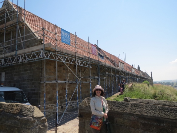
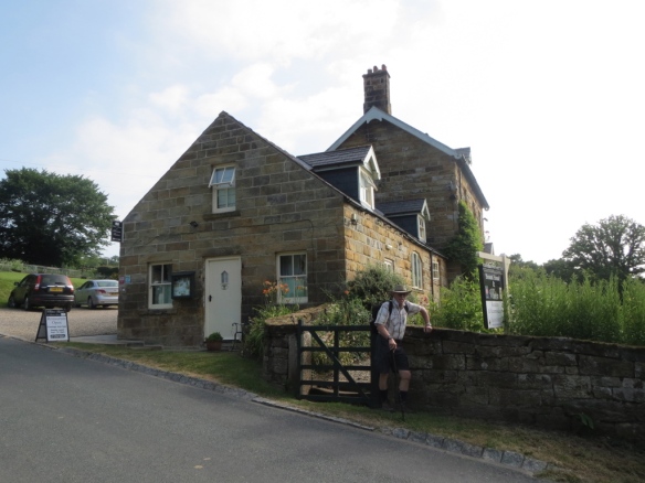
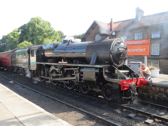
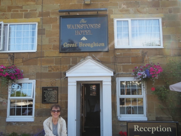
This post takes us as far as Great Broughton where we spent the night listening to revelers celebrating a 40th birthday party.

Once out of Richmond we set off for a day of tramping through fields with scenery that’s pretty but not stop-you-on-the-spot-to-admire gorgeous. Pretty pedestrian, if you excuse the pun.

That maybe explains why we got lost, which added a couple of hours to our day! On autopilot, not paying attention. We should have followed the River Swale—we still don’t know how we lost it—and by-pass Catterick, an army town, by a very wide margin. Instead we found ourselves smack bang in its centre, scratching our bewildered heads. Fortunately a local put us back on track.

Roman Catterick signboard
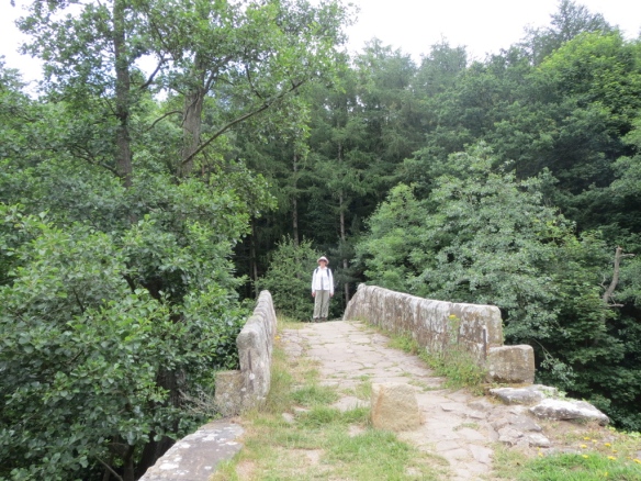
Next stop was Bolton-on-Swale churchyard—intended this time because we wanted to see the monument to Henry Jenkins, a local supposedly 169 when he died. Can you hear my yeah, right. The church in which he’s buried dates back to the 14th century. It’s worth a short stop to check out surviving bits from Saxon and Norman times.

From Bolton we were supposed to cut across a field occupied by a herd of steers and we had every intention of walking through them. We’d already braved herds of cows along the way, so we figured we could handle neutered bulls.

Err, no, we couldn’t.

The closer we got the more interested in us they became. It was when they started coming towards us our courage failed and we did a smart right angle turn, hopped across a stream, and fought our way through what seemed to be a never-ending patch of shoulder high stinging nettles. Were we relieved when we spied a fence with a road on the other side! Whew. Never want to repeat that!

Sorry, no photos of that experience!

I’m not going to say anything about our next B&B, Rawcar Farm, except that we didn’t want to leave the next morning. The photos say it all—those rooms are just the guest accommodation! It can accommodate two couples and as we were the only guests we had the place, and hosts Ian and Jane, to ourselves. Five stars all the way!!

Ian told us we would have been perfectly safe with the steers—which apparently have very curious natures, hence their interest in us—as long as we didn’t break into a trot. Run and it’s, as they say, all over Red Rover.

On from the farm there are miles of more flat land with the promise of the Cleveland Hills hanging like a beacon in the distance.

Cleveland Hills in the distance
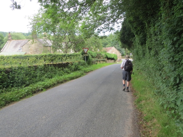
Before we reach them though, there’s the A19 to negotiate, which means dodging cars and trucks as you hare across the four lanes. That got the blood pumping!

To our relief—short lasting because we were soon puffing—we eventually started slowly upwards into the hills.

You know how sometimes it’s better not to know how far you’ve still got to go? This was one of those times. The road seemed to just keep winding and going ever upwards!

But then, hey presto, we were there. Park House B&B, with the hostess welcoming us with glasses of bubbly.

A comment I feel bound to make is that generally the B&B rooms that greeted us were all small. Park House took that to another level with just enough room to manoeuvre around a double bed.

Rooms are pretty small
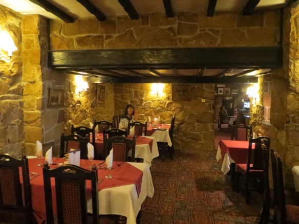
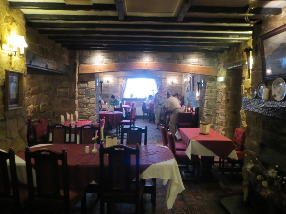
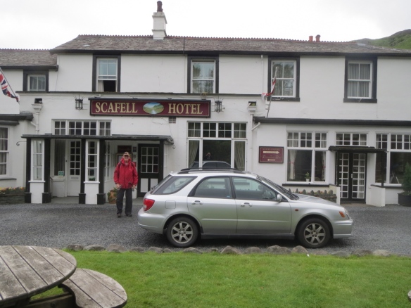
Couldn’t fault how well we were looked after though. Dinner that night ended with the biggest and creamiest Eton Mess I’ve ever had the misfortune of having to work my way through. Felt thoroughly sick by the time I’d finished. But it would have been downright rude to leave any, yes?

About a mile up from Park House our walk the next day was broken by a visit to the Mount Grace Priory ruins. If approaching via our route it’s down and around a few logging trails, so it took us a while to find. But worth it.

Mt Grace Priory ruinsDid you know those monks’ cells we hear about were in actual fact more like small townhouses!  Two storied with small gardens.  These monks even had servants.  So no more feeling sorry for those poor chaps in what I thought were small, dark and damp, bare stone one-room cells with barely enough space to move around.

Mt Grace Priory monks' cells
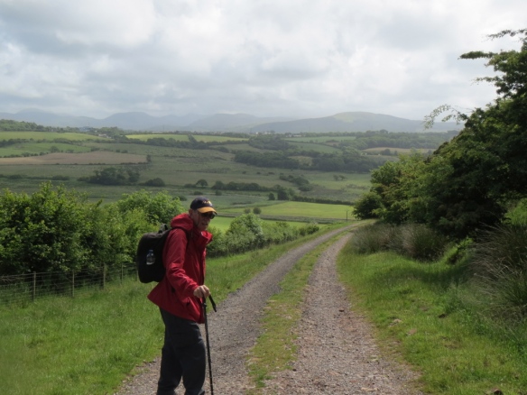
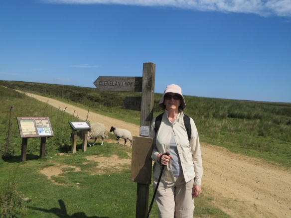
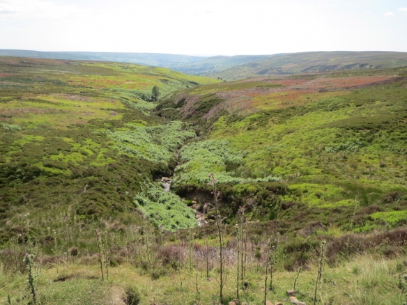
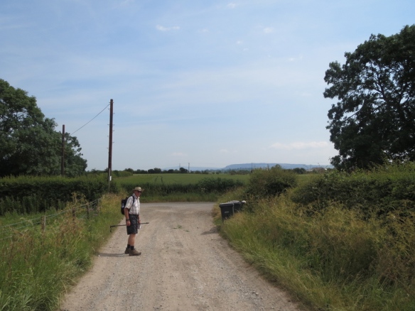
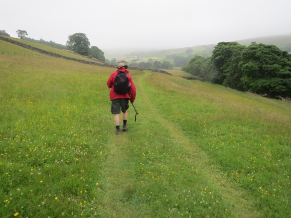
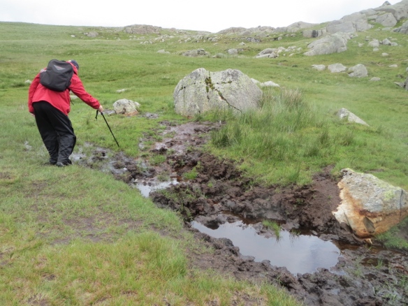
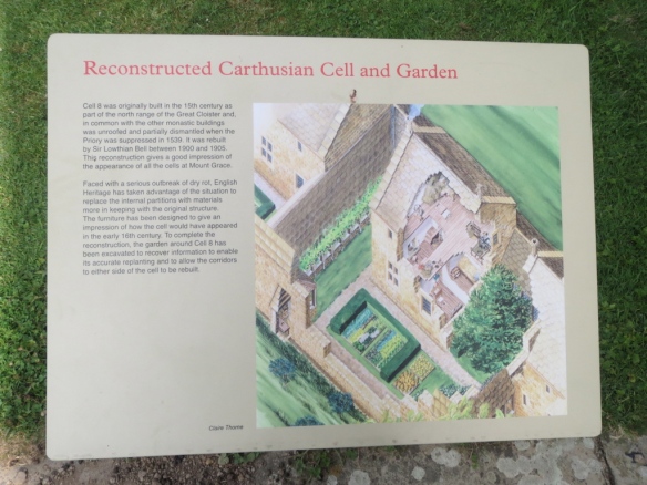
Look at the views we had on our walk today; 12 miles of absolute as-far-as-the-eye-can-see beauty.

At the end of which, at a spot called Clay Bank Top, we rendezvoused with our complimentary ride from our next accommodation, Great Broughton’s The Wainstone’s Hotel. No-one would stay in the town if they had to walk to it; much too far off the track.

Wainstones Hotel, Great Broughton

Wainstone's HotelAnd that’s where we laid our weary bones to listen to party noises until the wee hours. Ah well, some you win, some you lose.


Across England on the Coast to Coast walk, part 6

Over the last few weeks I’ve been recreating a walk my husband John and I did in July 2013. We hiked for 18 days across England, following the famous Coast to Coast walk from St Bees on the Irish Coast to Robin Hood’s Bay on the North Sea coast.

In the last post we had made it to the halfway point having traversed Cumbria and the Lake District to enter the Yorkshire Moors.

In this post I’ll take you from our last overnight stay in Keld, deep in the Pennines, to Richmond on their eastern side.

Once again I’ve loaded the post with photos. I hope you enjoy them.

From Keld to Reeth we had a choice of two routes: one high, one low. The guidebook suggests the high route for anyone interested in seeing the scars and ruins left from lead mining days. We opted for the more scenic Swaledale Valley route which takes in several little villages, one being Muker, where we took time out for a pot of tea in the local teashop.

A tiny, lovely, place with a claim to fame of being one of James Herriot’s favourite places. It’s just off the C2C path and involves walking through meadows of incredibly fragrant pasture land. Signs at the entrances ask you to stick to the paths and not trample the plants.

2--Walking through pasture

Walking through pastureland

3--A close-up of the pasture plants--they smelled wonderful

Pasture plants. The aroma is wonderful.

Once back on the road we noticed the trend towards increasingly hard to get through stiles and the ever-present abandoned stone buildings. Any takers for this duplex doer-upper?!

Our next stop, Reeth, is a quintessential Yorkshire village that featured frequently in the 1980s TV show All creatures great and small. It’s old enough to have got a mention in the Domesday book and has long been prosperous because of past lead mining and its role as the main market town for Swaledale.

Our B&B had the very grand name of Springfield House—before seeing it we thought we were in for something grand! Turned out to be a small private residence. Very nice though, with hosts who couldn’t do enough for us.

Next morning it’s on with the boots and once more on the road to head off to Richmond, a busy market town that’s the largest on the walk.

One of the things we never quite became used to was that the path often took us through farms, to the point where we’d be walking past the house and among the buildings. Always close the gates, is the motto.

8--On our way to Richmond. The path leads through yet another farm

Always close the gates behind you!

The walk is an easy one with a bit of a climb to Marrick, passing along the way the ruins of Marrick Priory, which have been absorbed into an Outdoor Education Centre.

We didn’t stop, content to take a photo from the path before continuing on and up through the woodland on what is known as the Nuns’ Steps. So-called because nuns are said to have laid the 375 steps as a walkway to the abbey.

The trail then becomes a long walk through farmland, heading towards Marske, half a mile out of which the guidebook told us to start looking for a white-painted cairn towards the top of Applegarth Scar.  Blowed if we could spot it!  After a minute of squinting I spied what I thought might be it only to find, through binoculars, that it was a reclining cow.

We ended up taking a punt, headed for the nearest hill and got lucky; it was the right hill!

Fortunately the rest of the walk into Richmond was straightforward, along paths alternately giving views of farms, the River Swale and woodland.

Until, at last, we spy Richmond from our lofty position above the town.
13--Our first view of Richmond

We have two nights booked at a B&B in the heart of the town. 17th century oak-beamed Willance House is just off the main square and it takes us only as long as a shower and change of clothes takes before we’re off and out exploring.

The town boasts the ruins of an 11th century castle built by Alan the Red. Not much remains as the stones were scavenged over the years by locals to build houses.

We could easily have stayed another day but our accommodation is pre-booked so we must be on our way.   We therefore bid farewell to Richmond.

17--Leaving Richmond


Across England on the Coast to Coast walk, part 4

Are you still with us? Dogging our footsteps across England along the famous Coast to Coast trail?

You’ll be relieved to learn that by this tales’ end we will have left the Lakes District and be on flatter ground.

But only after a harrowing 16 mile slog from Patterdale to Shap.

But that’s getting ahead of ourselves.

First there’s the short 7½ mile leg from Wordsworth’s home of Grasmere. As ever there’s scenery to die for.

Heading out of Grasmere

Heading out of Grasmere

It’s one hell of a climb out of Grasmere up to the mountain lake named Grisedale Tarn where the path diverges into several routes, two of which involve even more climbing.

This time, instead of feeling honour-bound to take the higher harder route on from the tarn, we cheerfully decide on the relatively gentle and downward slope into Patterdale, a walk of around two hours. Once there we head straight for the pub. Me for a pot of tea and John for a pint of the local beer.

Cup of tea at Patterdale hotel

Patterdale sits in a valley. A valley that RAF jets streak along practicing low level flying. We know because as we sat there contemplating the view and quiet two of them startled the bejesus out of us as they flashed past. After that bit of excitement we found our B&B for the night, an old school house decorated in the Balinese style. Have a look at our bed!

I seem to remember saying in my first post that we had two shattering days during the walk. Well, it’s a good thing we had a good night’s rest because the first is coming up! The Lakes definitely don’t want you to easily forget them!

After a lovely breakfast during which we were waited on by our hosts we were again on our way. Up and over yet another mountain, Kidsty Pike, one of the highest points on the walk. In the next photo I’m pointing in its general direction.

We know today is going to be hard because the guide book says so. It also says there are no villages, pubs, tea houses or toilets between us and Shap, our next stop 16 miles away. So, it says, be prepared for a slog of a day.

Kidsty Pike is the only mountain we have to climb and the guide book diagram shows the rest of the way is relatively level. I say relatively, because all of those little bumps in the drawing mean you’re going either up or down the entire way.

Kidsty Pike, the highest point in the original C2C walk

Kidsty Pike behind me

By the time you’ve scrambled, slipped and slithered your way down the shingly descent from Kidsty Pike to Haweswater Reservoir—which serves Manchester—you’re ready for a bit of easy travelling.

Forget that!

Haweswater Reservoir

Haweswater Reservoir

I couldn’t describe the next several hours better than the guide book so it’s over to its authors who say this is no …

… amble while spinning your dainty parasol … Soon you’re panting like a hippo on a treadmill high above the shore.

All while gritting your teeth because your toes are screaming from the downhill descent.

It’s at the further end of the reservoir we say goodbye to the Lakes District and start seeing the occasional C2C signpost. There follows several miles of fording streams, crossing stiles and negotiating bogs in lush lowlands before reaching the next landmark, the ruins of Shap Abbey.

Shap Abbey

Here you think, WooHoo, nearly there! You’re not. There’s still an hour or so to go. We recklessly eschewed the offer of a lift into town from some passing locals. No, we said, thanking them, but we feel that would be cheating. We must walk. Good grief, we thought afterwards, will we never learn!!

By the time we reached Shap, a long narrow village that pretty well lines the road, we were knackered and in need of a lie down.

Does it look like the sign is holding me up?

Does it look like the sign is holding me up? Believe me, it is!

As ever on this walk our accommodation had been pre-booked so it was just a matter of finding it. Which we did at the end of the village.

New Ing Lodge has a variety of room types as well as camping out the back. We were lucky enough to score the only room with an ensuite. At this stage of the game, lining up to use the shower and toilet would have been more than we could handle.

Next time we make it to the Pennines.

Across England on the Coast to Coast walk, part 3

We continue into the Lakes District with sometimes gritted teeth

It takes us five days to navigate our way across the Lakes District.

The weather’s at its worst for this part of our walk. There’s sunshine, sure—after all, it is summer—but the rain! There’s plenty of that too.

Rocky paths

Take, for example, our second day which took us from Ennerdale to Rosthwaite where, thank goodness, there was a lovely little hotel with a very comfortable room and good grub waiting. But first we had to cross a mountain. First we had to climb Loft Beck. I composed this about our experience scrambling up:

The second day in and the weather is foul,
we’re scaling Loft Beck and the wind it does howl,
what I would give
to be sure I will live,
is everything I’m carrying to survive.

The rain stings with little bullets of ice
that hit my exposed bits like pellets of rice,
it cascades down the rocks
soaking my socks,
I have doubts I will ever revive.

The wind roars and blows,
I can’t stem the flow from my nose,
snot flies to every point in the land
because I daren’t spare a hand.
All I want is to safely arrive.

Loft Beck

Grim, I was, determined not to be the one who slipped and needed a helicopter rescue. No, that was ‘fortunately’ someone else later that day. We heard about it at our hotel that night. The poor woman was pretty banged up having fallen quite a way.

Before beginning this walk we’d determined that if there was a choice between the low road and the high (mountain tracks) we were going to take the high. We reasoned we may never be this way again and we wanted to see as much of the scenery as we could.

Fine in theory. But when the mist hangs low and the rain is sleeting the guide book tells you to not be stupid. Besides, what are you going to see in zero visibility? Believe it or not we put in a couple of minutes debating, and felt that somehow we were wimps for not choosing the mountain.

Thank goodness for the several YHA huts along the way. Lunchtime saw us at Black Sail where we could sit in the dry for half an hour and buy a hot tea, coffee or chocolate. A big mug of chocolate got me! The little speck that looks like a tree to the right of John’s head is the hut. And the mountains we have yet to cross are behind.

Black Sail YHA

Once over and down the other side, which was nearly as hair-raising because of loose rubble, is an old slate mine that’s still in low-key operation.

Slate mine

Honester slate mine

The paths aren’t easy underfoot. We met people wearing footwear totally inappropriate for the terrain. Thank God, we muttered more than a few times, for good walking boots. I’d invested in a pair of Berghaus—the best, my UK son-in-law informed me with an impressed nod—and they were proving to be brilliant.

Paths that are streams

Here the path, awash with rain, intersects a dry stone wall and stile

It’s easy to get lost in the Lakes. There’s often no hint of a track and because it’s national park no signposting is allowed. To overcome this, walkers over successive years have built stone cairns to mark the way. Even so we wandered off course several times. Not too far, but enough to have us standing and scratching our heads while scanning the terrain for other walkers, which would show the way we should be heading.

And believe it or not, on those high peaks, in the middle of summer, you can get bogged.

Boggy ground

John went in ankle deep at this point. Unsympathetic me laughed and hopped across really quickly and only got muddy soles. The bogs aren’t always apparent and they’re everywhere. You can find yourself sinking on what looks like a firm grassy tuft.

Experienced walkers told us we were lucky. Most years the bogs are much worse and much more widespread. but early good weather had dried out a lot.

That day was a 16½ mile slog. But don’t get me wrong. We were glad to be there and the overnight stay in the Scafell Hotel at Rosthwaite revived us.

Scafell Hotel at :Rosthwaite

The next day was an easy 8½ miles to Grasmere, Wordsworth’s home for nine years and where he’s buried.

And it doesn’t get any lovelier than this!

The day was gorgeous so we took the high level route to Helm Crag which is the last peak before Grasmere and overlooks it.

The ridge walk via Helm Crag

It’s a relief to reach the bottom as it’s not an easy descent—were any of them!—and find yourself in Lancrigg Woods taking the Poet’s Walk into the village. The guidebook describes how:

Wordsworth’s sister Dorothy would sit at this spot while her brother walked up and down composing verses.

We could see why. It’s beautiful.

Next time: We say goodbye to the Lakes District.

I was there, Harrison Ford was there–so how did I miss him!

Earlier this week I was in Sydney for two days taking location photos for my novel imbroglio.

Sydney
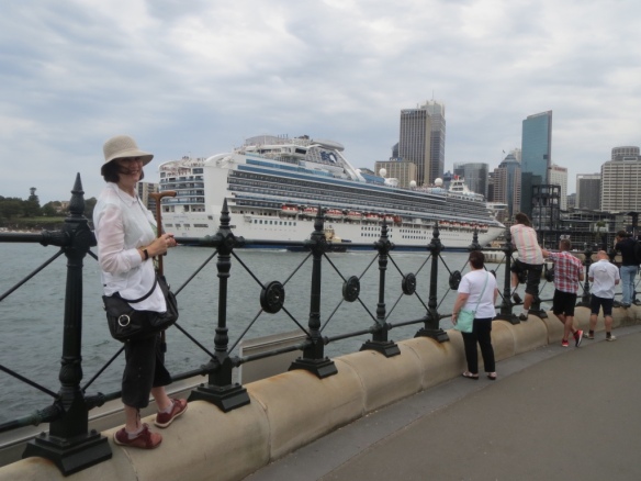
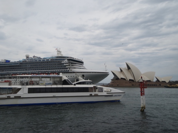
John and I drove from Canberra—an easy three-hour stretch given it’s a dual highway all the way. Until you hit the city, that is. Then it’s bumper to bumper, stop start, gridlock. I didn’t take any shots while in traffic; I was too busy keeping an eagle eye on the GPS for instructions and feeding them non-stop to John who was driving.

He needed a lie-down and strong coffee before I could get him out of the hotel and going again.

The weather forecast for the two days was for thunderstorms and lightning. Which was just my luck as I’d been wanting to do this for ages and now I’d finally organised it the weather was going to screw it up for me.

I had a list of the locations I wanted to photograph:

Coogee (one of the suburban beaches where my heroine Noel Valentine grew up)
Elizabeth Bay (where she now lives)
Hyatt Hotel on Circular Quay (where she makes her play for her boss, William T Hall), and
Darling Harbour (where David Cameron first sets eyes on Noel).

We booked into a back-street hotel in Wooloomooloo because it’s an easy 30 minute walk to Circular Quay, and from there we could take harbour ferries everywhere but Elizabeth Bay, which we called in to after booking out of the hotel to drive home.

The walk was lovely. Past the navy ships at the Garden Island base and the historic Finger Wharf (the longest timber-piled wharf in the world), then through the Botanic Gardens.

The beaches are lovely too. Coogee is a favourite of mine, which is why Noel calls it home and why she continues her morning swims there.

The next day we were catching up over lunch at Circular Quay with girlfriend and fellow author Roz Baker of the Sooner or later series fame. Then it was onboard the ferries to Watson’s Bay so I could take water-side shots of Rose Bay where another character, Marion Davies, lives. And lastly Darling Harbour.

The weather held!!

That night the thunder and lightning hit and the rain poured. But … I had all my photos. How lucky was I!

As for Harrison Ford, it was on the evening news I learned he was in town to promote the new Star Wars movie and the backdrop for his photos was the Opera House. I’m staggered I didn’t see him because I there was too!

Me and Diamond Princess

Diamond Princess, Opera House, ferry

Cruise ship Diamond Princess and the Opera House

I might have hung around and tried the selfie with him in the background trick.


Across England on the Coast to Coast walk, part 2

Across England on the Coast to Coast walk part 2

Well … today’s the day.

The first of 18 that see us walking from the west coast of the UK to the east coast. Through Cumbria and Yorkshire. Following Alfred Wainwright’s famous Coast to Coast walk.

The start

It’s been organised for us, so all we have to carry are our backpacks. Luggage will be transported between our nightly accommodation.

We’ve got B&Bs, hotels and farm stays lined up, some in the middle of towns, some in the middle of nowhere, and we’re looking forward to them all.

Recommended backpack inclusions are emergency medical supplies, water, lunch, snacks, raincoat, and little shovel/wipes/plastic bags for if you’re caught short.

It doesn’t take long—an hour or two on the road—to realise that’s WAY too much. In subsequent days we reduce it to band-aids, water and the minimum amount of food we think we’ll need.

As for being caught short—just make sure you do your ablutions before you head off in the morning and you can ditch the shovel etc as well.

Oh, and make sure your backpack is lightweight and waterproof—because if rain doesn’t soak it your sweat will.

But all that knowledge is in the future. Today we fortify ourselves with a full English breakfast (part of the package) and sandwiches packed by the B&B host.

Then it’s off and into the great outdoors, heading for the Lakes District. That’s those mountains in the distance.

On to Dent Hill

The first day covers 14½ miles. Mid-morning sees us puffing and doggedly panting up our first slope, Dent Hill.

Nearly killed John who began to feel very poorly early and didn’t improve for hours. At one point as we were slogging it to the top I had visions of calling in Air Rescue! But being a man he said he’d manage, and he did.

That smile on my face, you may notice, is definitely forced. In fact, our kids commented on our smiles after a few days of receiving photos, asking:

‘Are you having fun yet!’

Top of Dent Hill

The Lakes District is a hike of five days through the toughest countryside on the 4 out of 5 difficulty-rated walk, so we know we’re not in for an easy time.

Dent Hill turns out to be the worst we encounter that day; the rest is along tracks and over fences, this one deer-proof.

The sheepUp and over a deer-proof fence

We make it to Ennerdale and our overnight accommodation mid-afternoon, but as our hosts aren’t home we find the nearest pub and have a beer. Boy! Does it ever taste good—though as you can see, those smiles haven’t re-surfaced yet.

Ennerdale B&BBoy, that beer tastes good!

This becomes the pattern for the next 17 days. Hitting the road early so we arrive at our next destination at a reasonable hour.

Next week: Through the Lakes District with gritted teeth.